← Back to Home
Lake Bathymetry
Methods Development
Background
Lake morphometry is a driver of limnological processes, yet digitized bathymetry is lacking for most lakes. Here, we describe a method for efficiently extracting hypsography from bathymetric maps using ImageJ, validate the method with multiple users and digitize over 1,000 lakes in Minnesota, Wisconsin and South Dakota
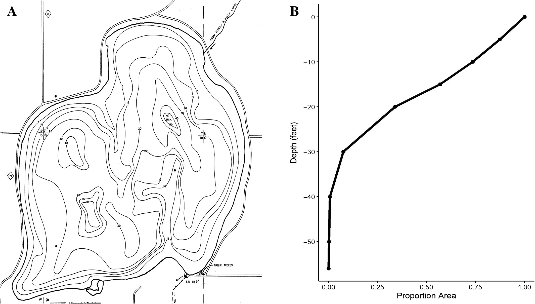
Figure 1. Conceptual diagram showing a bathymetric map (A) and a hypsographic curve for the map (B)..
My Approach
We digitized all of our lakes using state agency created maps in ImageJ. This process is faster than many ArcGIS based techniques. Rather than describing this method see the video below. To validate accuracy, we compared two digitzers to each other and to known hyspographic data.
Key Findings
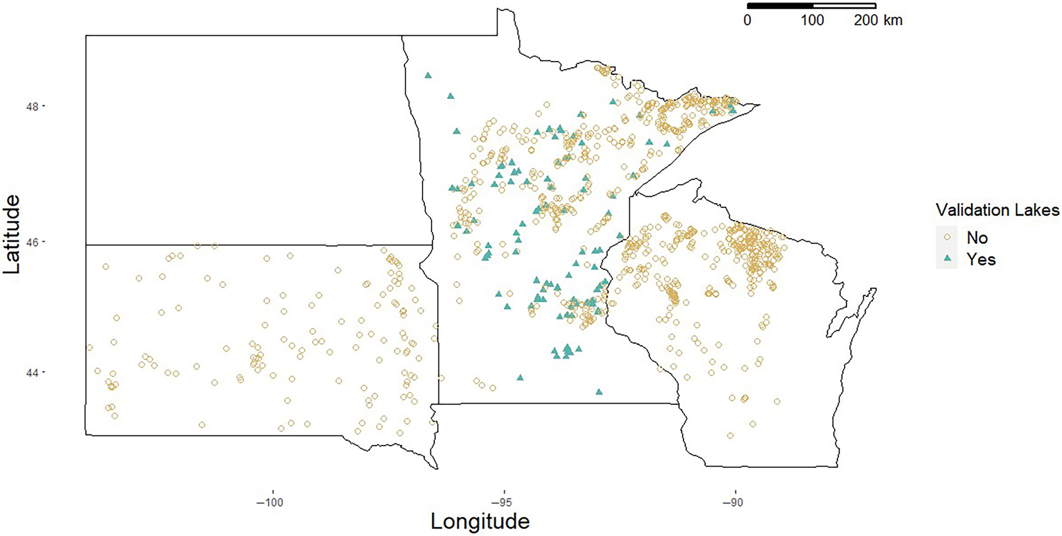
In total, we digitized 1,012 lakes from three different states throughout the upper Midwest USA. We found digitizers had high degrees of accuracy both with each other and with existing hypsographic data. We also show that using only maximum depth of a lake to estimate a hypsographic curve is generally unsuitable and inaccurate. Overall, this method improves ease of getting area-at-depth data from lakes, increases data availability and we encourage others in the limnological community to publish area-at-depth data on study lakes for future research purposes.
Figure 2.Locations of the 1,012 lakes digitized through this project.
Related Publications
Rounds CI, Vitense K, & Hansen GJA. (2023). Digitizing lake bathymetric data using ImageJ. Limnology and Oceanography: Methods, 21(10), 615–624.
Rounds CI, Vitense K, Hansen GJA & Van Pelt A. (2020). Digitization of Minnesota and Wisconsin bathymetric maps resulting in hypsographic data. Retrieved from the Data Repository for the University of Minnesota (DRUM), https://doi.org/10.13020/f3xa-5h34
Rounds CI, Vitense K, Hansen GJA & Van Pelt A. (2020). Digitization of Minnesota and Wisconsin bathymetric maps resulting in hypsographic data. Retrieved from the Data Repository for the University of Minnesota (DRUM), https://doi.org/10.13020/f3xa-5h34